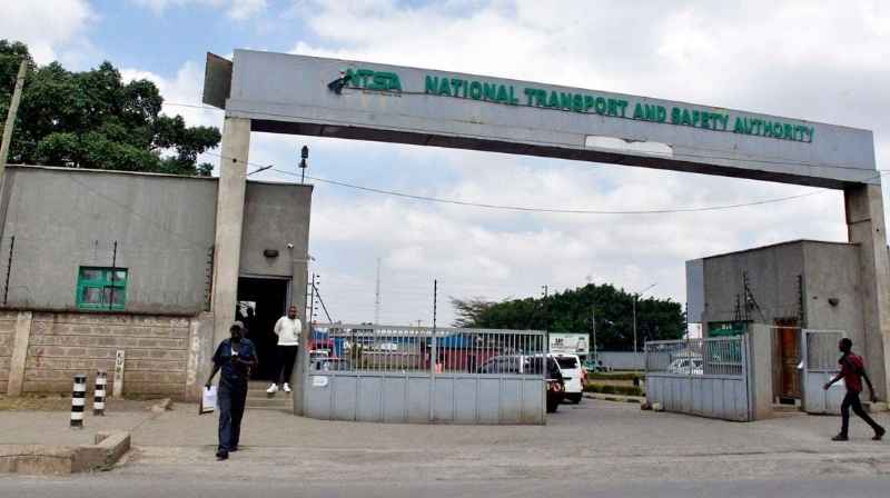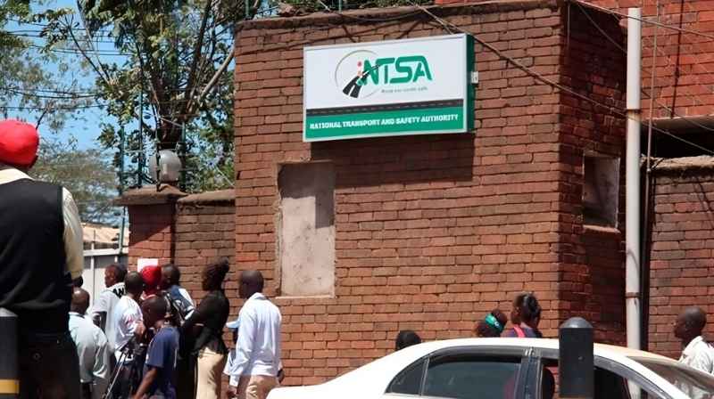

The National Transport and Safety Authority (NTSA) headquarters is located at 316 Upper Hill Chambers, 2nd Ngong Avenue, Nairobi. The office is different from the NTSA Vehicle Inspection Centre on Likoni Road, which primarily serves motorists travelling for vehicle inspection and related processes.
This Metros guide explains where NTSA headquarters is located, nearby landmarks and how to reach Upper Hill using public transport from Nairobi CBD and other parts of the city.
For vehicle inspections, use the NTSA Likoni Road Vehicle Inspection Centre guide instead.
Where is NTSA Headquarters in Nairobi?
NTSA headquarters is located at:
316 Upper Hill Chambers
2nd Ngong Avenue
Upper Hill, Nairobi
Upper Hill is one of Nairobi’s major commercial and government-office districts, immediately southwest of the CBD.
Before travelling, confirm that the particular NTSA service you require is handled at headquarters. A number of NTSA services are available digitally, while vehicle inspection is handled at designated inspection facilities.
NTSA Headquarters vs NTSA Likoni Road
These two destinations should not be confused.
NTSA Upper Hill is the authority’s headquarters and administrative location.
NTSA Likoni Road is associated with the Motor Vehicle Inspection Centre in Nairobi Industrial Area.
If your purpose is vehicle inspection, use the Likoni Road facility rather than travelling to Upper Hill.
How to Get to NTSA Upper Hill from Nairobi CBD
Upper Hill is relatively close to Nairobi CBD and can be reached using public transport serving Upper Hill, Ngong Road, Kenyatta National Hospital and surrounding corridors.
When boarding, tell the conductor you are travelling to Upper Hill and specify 2nd Ngong Avenue or Upper Hill Chambers.
The final part of the journey may require a short walk depending on the route and alighting point.
Using Ngong Road Matatu Routes
Passengers approaching Upper Hill through the Ngong Road corridor can use several routes already documented in the Metros transport database.
Route 2 Nairobi–Kawangware–Waithaka operates through the Ngong Road corridor and provides useful connections for passengers travelling between western Nairobi and the CBD side of Upper Hill.
Passengers should ask the conductor for the most appropriate alighting point for Upper Hill/Ngong Road before boarding.
From Kawangware and Dagoretti
Passengers travelling from Kawangware can use the Ngong Road corridor towards Nairobi.
The broad journey is:
Kawangware → Ngong Road → Upper Hill connection
Passengers should alight at the most convenient point for Upper Hill rather than continuing unnecessarily into the CBD.
The Route 2 Nairobi–Kawangware–Waithaka guide can be used to understand the wider corridor.
From Ngong Town
Passengers coming from Ngong can travel towards Nairobi through Ngong Road and connect to Upper Hill before reaching the central CBD.
Metros has mapped this corridor through the Route 111 Nairobi–Ngong Town guide.
Tell the conductor that your destination is Upper Hill and confirm the appropriate alighting point.
From Ongata Rongai
Passengers travelling from Ongata Rongai generally approach central Nairobi through Lang’ata Road.
Metros has mapped this corridor through the Route 125 Nairobi–Ongata Rongai guide.
Depending on the service being used, passengers can connect towards Upper Hill around the city-centre/KNH side of the journey.
Avoid travelling farther than necessary into the CBD if a convenient Upper Hill connection is available.
From Kiserian
Passengers from Kiserian generally travel through Ongata Rongai and Lang’ata Road towards Nairobi.
Use the Route 126 Nairobi–Kiserian guide to understand the main public transport corridor before connecting towards Upper Hill.
From Kasarani, Githurai and Thika Road
Passengers travelling from northern Nairobi can use the CBD as an interchange.
The broad journey is:
Kasarani/Githurai → Nairobi CBD → Upper Hill
Once in central Nairobi, connect to a matatu serving Upper Hill, Ngong Road or the KNH area.
For passengers starting in Kasarani, the Route 49 Nairobi–Kasarani guide provides the main connection towards the CBD.
From Eastlands
Passengers travelling from Umoja, Kayole, Donholm, Embakasi and other parts of Eastlands can generally travel towards Nairobi CBD before connecting to Upper Hill.
Where possible, choose a CBD alighting point that makes the Upper Hill connection easier rather than crossing the entire city centre.
The Nairobi Matatu Routes and Numbers database can help identify the appropriate first route.
Walking from Nairobi CBD
Upper Hill is geographically close to Nairobi CBD, but walking to 2nd Ngong Avenue can involve busy roads and uphill sections.
For passengers unfamiliar with the area, using a short public transport connection from the CBD may be easier.
Pedestrians should use designated crossings and footpaths where available.
Where Should You Alight?
Tell the conductor:
“Upper Hill, 2nd Ngong Avenue.”
You can also specify:
“Upper Hill Chambers.”
Do not simply ask for Upper Hill if you are unfamiliar with the district. Upper Hill covers a substantial area containing hospitals, government offices, banks, hotels and corporate buildings.
Confirm your alighting point with the conductor before departure.
Before Visiting NTSA Headquarters
Before making the journey, confirm whether your service actually requires an in-person visit.
Many vehicle and driver services are now handled through government digital systems, while physical vehicle inspections are carried out at designated inspection centres.
This can prevent travelling to Upper Hill for a transaction that should be completed elsewhere.
Other NTSA Locations in Nairobi
For an overview of NTSA destinations, use the NTSA Offices in Nairobi master guide.
If you are travelling for vehicle inspection, use the dedicated NTSA Likoni Road guide, which connects the facility with Routes 70, 71 and 72 and the wider Industrial Area transport network.
Metros Commuter Services Guide
The NTSA Headquarters Upper Hill guide forms part of the Metros Commuter Services Guide, which connects important government and public-service destinations with Nairobi’s public transport network.
The database is designed to answer two questions:
Where is the service I need?
How do I get there using public transport?
For routes throughout Nairobi, use the Nairobi Matatu Routes and Numbers database.
Information last verified: September 2026.