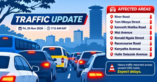
NAIROBI, Friday, November 20, 2026 — Motorists and public transport commuters travelling through Nairobi’s Central Business District (CBD) are facing heavy traffic congestion this morning, with several major streets showing significant traffic buildup.
A traffic map reviewed by Metros Kenya at approximately 7:12 a.m. shows extensive red markings across the downtown road network, indicating heavy congestion along River Road, Tom Mboya Street, Kenneth Matiba Road, Ronald Ngala Street and sections of Moi Avenue.
The congestion appears particularly pronounced around the Kenya National Archives, Odeon Cinema and the streets connecting the northern CBD to Haile Selassie Avenue.
River Road Among the Most Affected
River Road is experiencing widespread congestion, with several sections marked red on the traffic map.
The road, which connects multiple commercial streets within downtown Nairobi, is among the most heavily affected corridors in the morning traffic snapshot.
Kenneth Matiba Road and nearby connecting streets are also showing significant congestion, potentially complicating movement between River Road and the central business district.
The situation is particularly important for commuters using public transport services operating within the downtown area.
Tom Mboya Street and Archives Area Under Pressure
Traffic conditions are also difficult along Tom Mboya Street, particularly around the Odeon Cinema and Kenya National Archives area.
The traffic map shows red markings along several connecting roads, suggesting that congestion is affecting more than one junction.
The Archives area is a major pedestrian and public transport interchange, meaning slow vehicle movement could disrupt commuters accessing nearby boarding and drop-off points.
Motorists approaching this section of the CBD should anticipate delays.
Moi Avenue and Kenyatta Avenue Record Slow Traffic
Along Moi Avenue, the traffic map displays a mixture of orange and red markings, indicating varying levels of congestion.
Traffic appears particularly slow along sections approaching the downtown commercial district.
The junctions connecting Moi Avenue with Kenyatta Avenue and surrounding streets are also experiencing traffic pressure.
Although some sections appear to be moving better than the heavily congested River Road corridor, motorists should not expect uninterrupted movement.
Racecourse Road and Haile Selassie Avenue Also Affected
Further east, Racecourse Road is showing extensive red markings, particularly along the section approaching Haile Selassie Avenue.
Heavy congestion is also visible along parts of Ronald Ngala Street and nearby connecting roads.
The simultaneous buildup across these streets suggests that motorists attempting to bypass one congested corridor could encounter similar conditions on adjacent roads.
What This Means for Public Transport Commuters
The congestion could affect public transport operations across the CBD, particularly vehicles accessing stages and navigating the downtown street network.
Buses and matatus operating through the affected corridors may experience longer turnaround times, potentially affecting passenger waiting times.
However, the traffic map does not provide verified information about individual bus routes, stage closures or specific service delays.
For commuters travelling relatively short distances within the CBD, walking may be a more practical option where pedestrian routes are safe and accessible.
The congestion also highlights the importance of improving public transport efficiency through better traffic management, reliable mass transit and dedicated bus priority infrastructure.
Modern electric city buses operating within a properly managed public transport network could offer a cleaner alternative to conventional diesel-powered services, although electrification alone would not eliminate congestion without effective road-space management.
What Is Causing the Traffic?
The precise cause of this morning’s congestion has not been independently established.
The available traffic map shows the extent of slow-moving traffic but does not confirm whether the buildup is associated with roadworks, accidents, vehicle breakdowns, traffic diversions or routine morning commuter demand.
Motorists should therefore avoid assuming that a particular incident is responsible for the delays.
Nairobi CBD Traffic: Roads to Watch
Based on the traffic snapshot reviewed by Metros Kenya, the most affected corridors include:
- River Road: Heavy congestion across multiple sections.
- Tom Mboya Street: Significant congestion around Odeon and Archives.
- Kenneth Matiba Road: Heavy traffic along sections connecting the northern CBD.
- Moi Avenue: Slow movement, with orange and red traffic indications.
- Ronald Ngala Street: Congestion along highlighted sections.
- Racecourse Road: Heavy traffic towards Haile Selassie Avenue.
- Kenyatta Avenue: Congestion near the Moi Avenue junction.
- Haile Selassie Avenue: Traffic buildup on the eastern CBD approach.
Metros Kenya Traffic Watch
Metros Kenya continues to highlight road conditions affecting commuters and public transport users across Nairobi.
The current traffic snapshot indicates that congestion is spread across several interconnected downtown streets, rather than being concentrated at a single junction.
Motorists travelling through the CBD are advised to allow additional journey time and check updated traffic conditions before setting off.
Traffic information: Based on a map snapshot supplied for analysis on Friday, November 20, 2026, at approximately 7:12 a.m. Traffic conditions may have changed since that observation.
Metros Kenya — Make Public Transport Great Again.