
NAIROBI, Kenya — Imagine spotting a dangerous pothole on your morning commute, taking a photograph with your phone and reporting it to Nairobi County.
Instead of the complaint disappearing into a social media thread, you receive a tracking number.
The report is automatically sent to the department responsible for that road. You can see when it is assigned, when repairs begin and when the work is completed. The county then uploads photographic evidence showing what was done.
Now imagine the same digital system receiving information from traffic cameras, pollution sensors, public transport systems and thousands of other residents across Nairobi.
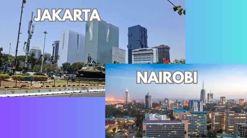
That is broadly the direction Jakarta has taken with its smart-city programme — and it presents an interesting question for Kenya’s capital:
Could Nairobi use technology not simply to observe its urban problems, but to respond to them faster?
The question comes from original reporting by Capital FM Africa journalist Bruhan Makong, following a familiarisation visit by Kenyan journalists to Jakarta, Indonesia, where Jakarta Smart City head Ponirin Ariadi explained how the city combines citizen reports with information from government departments, CCTV cameras, sensors and increasingly artificial intelligence.
For Metros, the particularly interesting part of the Jakarta story is transport.
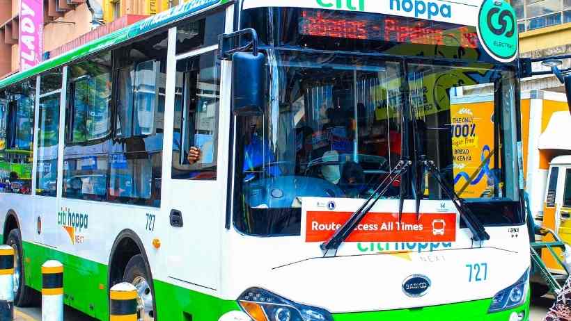
Nairobi already has matatus, buses, commuter rail, boda bodas, major highways and emerging intelligent traffic systems.
What it does not yet have is a completely integrated system connecting all of them.
Jakarta starts with something simple: tell us what is wrong
Jakarta’s JAKI application allows residents to report problems they encounter around the city.
A resident can photograph a problem and submit information through the platform.
The complaint then enters the city’s digital system, where it can be categorised and directed to the appropriate government unit.
Residents can follow the progress of their complaint, while officials can provide photographic evidence once an intervention has been completed.
That sounds simple.
But the important innovation is not necessarily the application.
It is what happens behind it.
Citizen reports problem → system identifies responsibility → department receives report → action is taken → citizen sees the result.
For Nairobi, that distinction matters.
Kenya already has sophisticated digital government platforms.
The bigger question is whether information reported by residents can be connected directly to the people responsible for solving the problem.
Imagine applying that system to Nairobi’s roads
Nairobi provides almost endless opportunities for such a system.
A traffic light stops working.
A pothole develops.
Floodwater covers a section of road.
A broken-down vehicle blocks a lane.
A drainage channel becomes clogged.
A road is unexpectedly closed.
Instead of hundreds of motorists discovering the problem individually, information from residents and city systems could potentially create a live picture of what is happening.
That would be particularly useful because Nairobi’s roads function as interconnected corridors.
Metros’ Nairobi Major Roads and Transport Corridors guide maps the importance of Thika Road, Waiyaki Way, Mombasa Road, Jogoo Road, Outering Road, Ngong Road, Lang’ata Road and the city’s bypasses.
A problem on one of those roads rarely affects only that road.
Traffic escaping one corridor can quickly move onto another.
A genuinely intelligent traffic system therefore needs to understand the network rather than simply watch individual junctions.
Jakarta is turning CCTV cameras into sources of data
This is where Jakarta’s experience becomes more interesting.
According to the Capital FM Africa report, Jakarta began working with private-sector partners on CCTV deployment in 2015.
The cameras have evolved beyond their traditional security function.
Jakarta officials said information generated by CCTV can include counts of people and vehicles, while traffic information can contribute to route analysis and wider decisions about movement around the city. The city is targeting around 30,000 cameras within the next two to three years.
For Nairobi, the lesson isn’t simply:
Install more cameras.
A camera that records a traffic jam is useful.
A camera that identifies unusual congestion, feeds the information into a traffic-management system and helps authorities respond is much more useful.
That distinction becomes important as Nairobi develops more intelligent transport infrastructure.
What if Nairobi knew a traffic jam was forming before commuters did?
Consider Thika Road during the evening commute.
Thousands of vehicles are moving towards Kasarani, Roysambu, Githurai, Ruiru and surrounding areas.
Suddenly traffic begins building unusually quickly.
An integrated system could potentially combine CCTV information, traffic speeds and incident reports to identify the cause.
Perhaps there has been a crash.
Perhaps a vehicle has broken down.
Perhaps another road has flooded and motorists are diverting.
Instead of commuters discovering the problem only after joining the queue, authorities could distribute information earlier.
Journey-planning systems could potentially suggest alternatives.
Traffic officers could be deployed.
Public transport operators could receive information.
That is where a smart city becomes more than cameras and control rooms.
It becomes commuter intelligence.
Nairobi already has an enormous transport network
There is another reason the Jakarta discussion matters.
Nairobi does not need to invent a public transport network from scratch.
Much of it already exists.
Metros’ Nairobi Matatu Routes and Numbers database documents routes running across the city’s major roads and neighbourhoods.
Behind those routes are numerous operators documented in the Nairobi Matatu SACCOs, Routes and Destinations directory.
Then there are the physical places where passengers actually change vehicles.
The Nairobi Bus Stations, Matatu Stages and Termini guide shows how public transport is distributed across different CBD boarding points, with Railways already functioning as an important interchange between road and railway transport.
The infrastructure exists.
The problem is that passengers frequently experience its different components as separate systems.
This is where Jakarta offers perhaps its biggest transport lesson
Jakarta has worked towards connecting different forms of public transport.
Capital FM Africa reports that TransJakarta connects with the city’s MRT and LRT systems, while traditional services have also been reorganised within the wider JakLingko framework.
Payment integration forms part of the system, allowing the passenger journey to be viewed as a connected movement rather than a series of unrelated transport transactions.
Compare that with Nairobi.
A commuter may start with a matatu.
They pay.
They reach the CBD.
They walk to another stage.
They board another matatu.
They pay again.
Another passenger might connect to commuter rail and then take a boda boda for the final kilometre.
Each service works.
But the passenger is responsible for stitching the entire journey together.
What if Nairobi treated that as one journey?
Imagine travelling from Eastlands to Industrial Area.
Instead of simply searching for individual vehicles, a Nairobi transport platform could tell you the entire journey.
It could identify your nearest matatu.
It could show where to board.
It could tell you where to change vehicles.
It could warn you about a road closure.
It could identify a rail connection where appropriate.
And it could estimate the complete journey rather than treating each stage independently.
Metros’ existing Nairobi CBD to Industrial Area transport guide demonstrates why that matters. Industrial Area itself covers multiple roads, including Enterprise Road, Lunga Lunga Road, Likoni Road and Lusaka Road, meaning simply saying “Industrial Area” is not enough to identify the best public transport journey.
The same problem exists across Nairobi.
A useful transport system has to understand destinations at neighbourhood and street level.
Matatus would have to be part of the solution
Any attempt to create a Nairobi integrated transport system would face one unavoidable reality:
Matatus cannot be treated as an inconvenience sitting outside the formal transport network. They are a central part of the network itself.
Metros’ route database demonstrates the scale of that system.
Routes extend from major highways down to local corridors such as Kinyanjui Road, which connects Ngong Road with Riruta, Kabiria and Satellite.
In eastern Nairobi, places such as Kayole Junction function as transfer points connecting Kayole, Komarock, Njiru, Spine Road, Kangundo Road and Outer Ring Road services.
Those local connections are exactly what a mass-transit system needs for the first and last parts of a passenger’s journey.
The challenge is integration.
One payment system could change the commuter experience
Payment is another area where integration becomes important.
Today, a Nairobi commuter changing between different operators may have to make several independent payments.
A genuinely integrated network could eventually allow passengers to pay across participating services using a common system.
That would not necessarily mean abolishing private operators.
It would mean developing standards allowing different operators and transport modes to participate in the same passenger ecosystem.
The passenger would begin thinking less about individual operators and more about the journey.
That is a substantial shift.
Weather should eventually become part of transport information too
A smart transport system also needs to understand that roads do not operate under identical conditions every day.
Nairobi rain demonstrates this clearly.
A heavy downpour can slow traffic, flood a road, change boda boda demand, delay matatus and force motorists onto alternative routes.
A commuter looking at a weather forecast is therefore often asking a transport question:
What will this weather do to my journey?
That is why Metros increasingly connects its Nairobi transport coverage with weather information.
A commuter can check the Nairobi Weather Today and This Week forecast before travelling, particularly when rainfall could affect road conditions.
In a more advanced city transport system, weather information, road conditions, traffic and public transport operations would increasingly communicate with one another.
Artificial intelligence could help — but it cannot repair Nairobi
Jakarta is also experimenting with artificial intelligence.
According to Capital FM Africa’s reporting, AI is being introduced into parts of the city’s reporting and verification processes, including analysis of images submitted as evidence that problems have been addressed.
Officials also acknowledged the complications, including manipulated images and deepfakes.
That is an important warning for Nairobi.
AI can process information.
It can identify patterns.
It can potentially detect congestion or categorise citizen reports.
But it cannot physically repair a road.
It cannot unclog a drainage channel.
It cannot tow a broken-down truck.
Technology only becomes useful when there is an institution capable of acting on the information it produces.
Jakarta’s garbage lesson applies directly to Nairobi transport
Capital FM’s reporting makes this point particularly well through waste management.
Jakarta can use technology to receive reports of garbage, monitor pollution and route information to responsible agencies.
But technology does not collect the garbage.
Workers, equipment, financing and functioning institutions still have to do that.
Exactly the same principle applies to Nairobi traffic.
A sophisticated system can identify a pothole.
Someone still has to repair it.
A camera can identify a stalled vehicle.
Someone still has to remove it.
An application can show that a road has flooded.
Drainage infrastructure still has to work.
A journey planner can identify a poor public transport connection.
Transport planners still have to improve the interchange.
Nairobi isn’t starting from zero
That may be the most important point.
Nairobi already has digital government services and is developing traffic-monitoring and management capabilities.
Jakarta itself took years to build its current model.
Capital FM’s reporting notes that the Indonesian city’s approach developed through sustained investment in technology, transport, infrastructure, regulation and government capacity.
Nairobi therefore does not need to wake up tomorrow with a Kenyan version of Jakarta’s entire system.
A more realistic starting point would be connecting systems that already exist.
Traffic information should communicate with road-management agencies.
Road closures should feed into commuter information.
Weather warnings should influence transport alerts.
Public transport data should allow passengers to understand connections.
Citizen complaints should reach the institution responsible for fixing them.
Nairobi should not simply copy Jakarta
There is also an important limit to the comparison.
Jakarta and Nairobi have different populations, institutions, transport histories, infrastructure and regulatory environments.
Capital FM Africa itself notes that Jakarta cannot simply be treated as a template that Nairobi can copy wholesale.
The valuable part is the principle behind the system.
Information has to lead somewhere.
A citizen reports a problem.
Responsibility is assigned.
Government acts.
The citizen can see what happened.
A camera detects congestion.
The information reaches traffic managers.
A response follows.
A transport system generates data.
That information helps improve the next journey.
The smartest Nairobi won’t necessarily have the most cameras
It is easy to make smart cities about impressive technology.
Thirty thousand cameras sound impressive.
Artificial intelligence sounds impressive.
Sensors, applications and control centres look impressive.
But commuters ultimately judge a transport system differently.
Did I know there was a problem before I reached it?
Could I find another route?
Could I move easily between a matatu, train and bus?
Was the broken traffic light repaired?
Was the flooded road cleared?
Did somebody actually respond when the problem was reported?
That is where Jakarta’s experience becomes relevant to Nairobi.
The real measure of a smart city may not be how much information it collects.
It may be how quickly that information becomes useful action.
And for Nairobi’s millions of daily commuters, that could eventually be the difference between technology they merely hear about and technology they actually experience on the journey home.
Editor’s note: This Metros Kenya analysis draws on original reporting by journalist Bruhan Makong for Capital FM Africa following a familiarisation visit by Kenyan journalists to Jakarta, Indonesia. Capital FM Africa’s reporting provided the first-hand accounts and information about Jakarta Smart City used as the basis for this Nairobi-focused transport analysis.